|
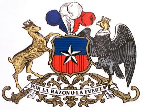
Santiago 2018 Winter Olympic Games |
|
|
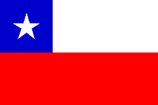
The Country
|
|||||||||
|
When the first Spanish arrived, Quechua tribes inhabited the northern region, and Araucanian tribes inhabited the central
region and the northern part of the sothern region. The Incas were in control of the northern area and part of By the mid-seventeenth century, the population of the Spanish settlements and their surroundings numbered approximately
100,000. This population grew to about 500,000 by mid-eighteenth century and to one million by 1830. Those with European blood
were concentrated in central Chile , between Santiago and Concepcion ; few settled in the northern and southern regions. This
pattern of dispersion began to change only in the second half of the nineteenth century, with the rapid growth of mining activities
and the inmigration of non-Iberaian Europeans as germans, italians and yugoslaves. Under Spanish colonial rule, northern and central Chile were part of the Viceroyalty of Peru. The south remained under
the control of the Araucanians almost until the nineteenth century. Independence was first declared in 1810. At that time,
central Chile was to a large extend controlled by a small, upper class of criollos (locally born Europeans), most
of them owned large estates. A period of internal instability and striffe followed, which resulted in the restoration of Spanish
rule in 1814. Chile defeated Bolivia and Peru in the War of the Pacific (1879-1883) for the control of the Atacama Desert and its
rich mineral deposits. In the course of this war, Chilean troops occupied Lima. Chile won the disputed territory. Bolivia
lost its outlet to the open sea and Peru the Tarapaca district. A multiparty, parliamentary regime came into being in 1891, however, the interests of the upper class, comprised mainly
of owners of large states and wealthy business people, continued to predominate. After a short period of military rule (1924-1925),
followed by the reinstatement of the democratically elected president Arturo Alessandri, a new, more progressive, constitution
came in force (1925). Left-wing parties, including communist, gained much influence from 1930s onward and played an important
role in elections of several presidents. However, the right-wing parties ramained in actual control. In 1960, an incredible
earthquake destroyed the South of the country, but Chile could organize the FIFA World Cup in 1962. A presidential candidate of the left-wing parties, Salvador Allende, Images: 1. Pedro de Valdivia, conqueror of Chile; 2. Bernardo O'Higgins, Supreme Director of the Republic
and Liberator of the Nation; 3. President Salvador Allende Gossens.
|
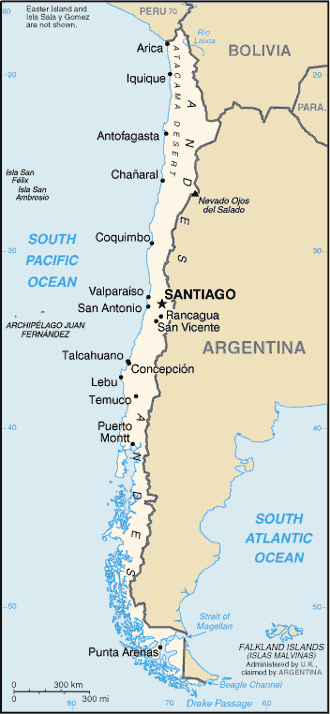
The northern Atacama desert contains great mineral wealth, primarily copper and nitrates. The relatively small Central
Valley, which includes Santiago, dominates the country in terms of population and agricultural resources. This area also is
the historical center from which Chile expanded in the late 19th century, when it integrated the northern and southern regions.
Southern Chile is rich in forests and grazing lands and features a string of volcanoes and lakes. The southern coast is a
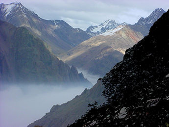
labyrinth of fjords, inlets, canals, twisting peninsulas, and islands. The Andes Mountains are located on the eastern border. Chile is the longest (N-S) country in the world (over 4,200km), and also claims a large section of Antarctica as part of
its territory. Also, Chile controls Rapa-Nui, Easter Island, the easternmost island of Polynesia, which it incorporated to
its territory in 1888, and Robinson Crusoe Island, some 400 km from the mainland, in the Juan Fernandez archipelago. Since Chile lies deep in the Southern Hemisphere, the seasons fall at opposite times of year from the Northern Hemisphere.
Thus, the summer months are December, January and February, while June, July and August are the winter months. When it is
spring in North America or Europe , it is autumn in Chile , and vice versa. January and February are the peak travel months
except, of course, at ski resorts. Needless to say, it is essential to take the inversion of seasons into account when planning
a trip. Chile 's far south has a cool, damp climate, but severe cold is rare except at higher elevations. The moderating effect
of the ocean prevents extreme heat waves in the summer and keeps temperatures from falling very low in the winter. Thus there
is very little difference in temperature from one season to the next. Average annual temperatures are 6 °C at Punta Arenas
in the far south, 11 °C at Puerto Montt further north, 14 °C at Santiago, 16 °C at Antofagasta and 18 °C at Arica in the far
north. Rainfall, on the other hand, is more variable. North of 27 ° South latitude , there is virtually no rainfall at all.
Moisture comes mostly in the form of heavy mists. In north-central Chile , rainfall is heaviest in the winter months. As a general rule, precipitation increases as you head
south, culminating in south-central Chile , where it rains year-round and sometimes heavily. The area around Cape Horn can often be stormy. Rainfall tends to be lighter in some other parts of the far south such as
Punta Arenas , which falls in the rain shadow of the drier eastern slopes of the Andes. Chile can be divided into three major climatic areas— very arid in the north, cool and damp in the south, and what
can be characterized as a Mediterranean climate in central Chile , with pronounced seasonal differences: heavier rainfall
in the cooler months from May to August, and sunshine the rest of the year. It does occasionally snow in Santiago and other
parts of central Chile , but the snow usually melts quickly except in the mountains. In the north, the interior of the Atacama
desert has some of the world's highest levels of solar radiation.
|
||||||||
|
|
|||||||||

 central Chile. Warlike Araucanian tribes, who held the Incas back, dominated much of the rest of the country . The first
Spanish settlements were established in the mid-sixteenth century: Santiago de Nueva Extremadura in
1541 and Concepcion in 1550 by the spaniard Pedro de Valdivia. Spanish settlers, mainly from Andalucia, were attracted to
central Chile because of the pleasant climate and fertile soil. The settlers had to face repeated assults from the Araucanians.
The on-and-off war with the Indian aborigines continued into the second half of the nineteenth century.
central Chile. Warlike Araucanian tribes, who held the Incas back, dominated much of the rest of the country . The first
Spanish settlements were established in the mid-sixteenth century: Santiago de Nueva Extremadura in
1541 and Concepcion in 1550 by the spaniard Pedro de Valdivia. Spanish settlers, mainly from Andalucia, were attracted to
central Chile because of the pleasant climate and fertile soil. The settlers had to face repeated assults from the Araucanians.
The on-and-off war with the Indian aborigines continued into the second half of the nineteenth century.
 Combined Argentinian and Chilean forces under Jose de San Martin and Bernardo O'Higgins, who crossed the Andes from Argentina
, managed to defeat and drive out the Spanish army and restore Chile's independence (1818). O'Higgins became Chile's first
leader.
Combined Argentinian and Chilean forces under Jose de San Martin and Bernardo O'Higgins, who crossed the Andes from Argentina
, managed to defeat and drive out the Spanish army and restore Chile's independence (1818). O'Higgins became Chile's first
leader. won the elections in 1970. Upon ussuming office, he nationalized the mines, industries, and public services. Allende was deposed
and died in a military coup in September 1973, which was followed by 16 years of military dictatorship by General Augusto
Pinochet. Democratic elections were held in 1989 and in 1990 with the asumption of the presidency by Patricio Alwin Azocar,
the chilean democracy returned. In 2000 assumed the first socialist president since Allende, Mr. Ricardo Lagos Escobar.
won the elections in 1970. Upon ussuming office, he nationalized the mines, industries, and public services. Allende was deposed
and died in a military coup in September 1973, which was followed by 16 years of military dictatorship by General Augusto
Pinochet. Democratic elections were held in 1989 and in 1990 with the asumption of the presidency by Patricio Alwin Azocar,
the chilean democracy returned. In 2000 assumed the first socialist president since Allende, Mr. Ricardo Lagos Escobar.